Site facts

The property at a glance.

Location
Davis Road & Snake Road, Limestone County, Alabama
Size
Approximately 300 acres
Waterfront
About one mile on Lake Wheeler (Tennessee River), east of the Elk River confluence
Access & utilities
Two county roads; water and power available along both
Drive times
About 15 minutes to Athens and 25 minutes to Huntsville
Current use
Pasture, hay fields and mature hardwood forest; held by one family for 75+ years
Concept program
Approximately 300 homesites (townhomes to one-acre estate lots), marina and waterfront recreation, mixed-use/commercial and open space
Shoreline
Lake Wheeler is a TVA reservoir; docks and other shoreline structures require TVA Section 26a approval
Zoning & entitlements
To be confirmed

Approximate; to be verified during due diligence.

Conceptual plans

One way the land could come together.

Illustrative concepts to frame discussion — not engineered, surveyed or approved.

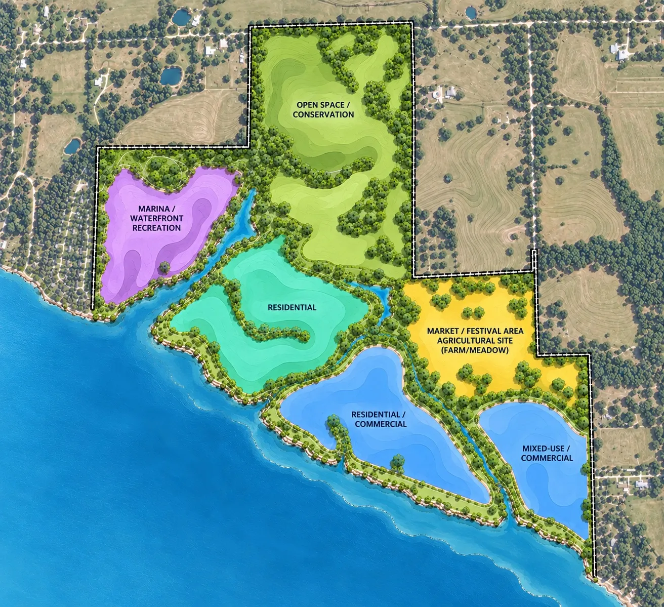
Conceptual Land-Use Plan View larger

Sheet 1

Conceptual Land-Use Plan

Illustrative land-use zones: marina and waterfront recreation, residential, residential/commercial, mixed-use/commercial, a market, festival and agricultural area, and open space/conservation.
Site Topography (Preliminary) View larger

Sheet 3 · Topography

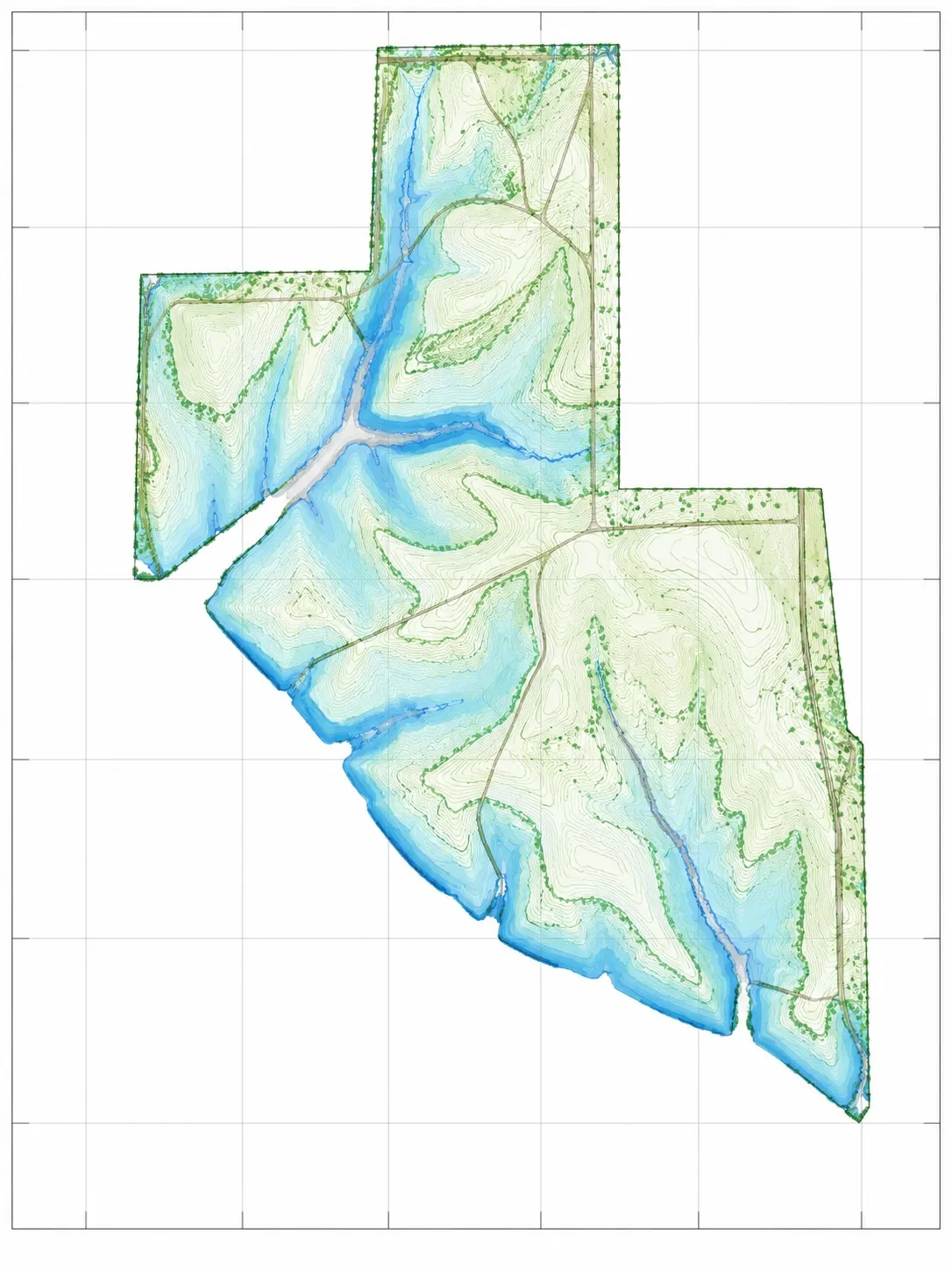
Site Topography (Preliminary)

Preliminary elevation map of the property, shaded from low ground near the water (blue) to higher ground (green). Not a survey; a full topographic survey will be provided separately.

  • Gentle ridges and open fields on the higher ground inland
  • Drainages running down to coves along the shoreline
  • Long frontage on the main body of the lake

Documents

Downloads.

  • Developer packageCover, site facts and all sheets in one PDF
    PDF · 2.3 MB
  • Sheet 1 — Conceptual Land-Use PlanLetter, landscape
    PDF · 778 KB
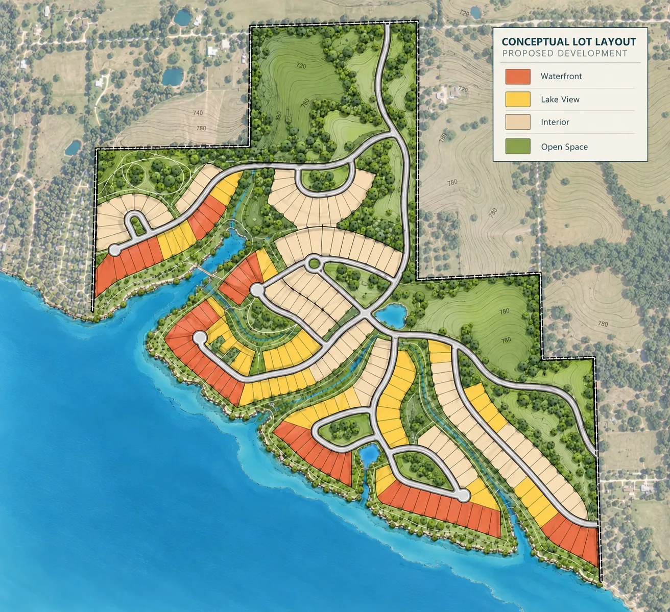
  • Sheet 2 — Conceptual Lot LayoutLetter, landscape
    PDF · 730 KB
  • Sheet 3 — Site Topography (Preliminary)Letter, portrait
    PDF · 441 KB
  • Topographic surveyProfessional survey of the property
    Coming soon

More about the land itself — drone film, concept renderings and photos — is on the main page.

Sadler Farms represents a potential development opportunity. All plans, layouts, lot counts, uses and renderings are conceptual and illustrative only, are not engineered or surveyed, and are subject to planning, engineering, governmental approvals and permitting. Acreage, shoreline length, utilities and travel times are approximate and should be independently verified.